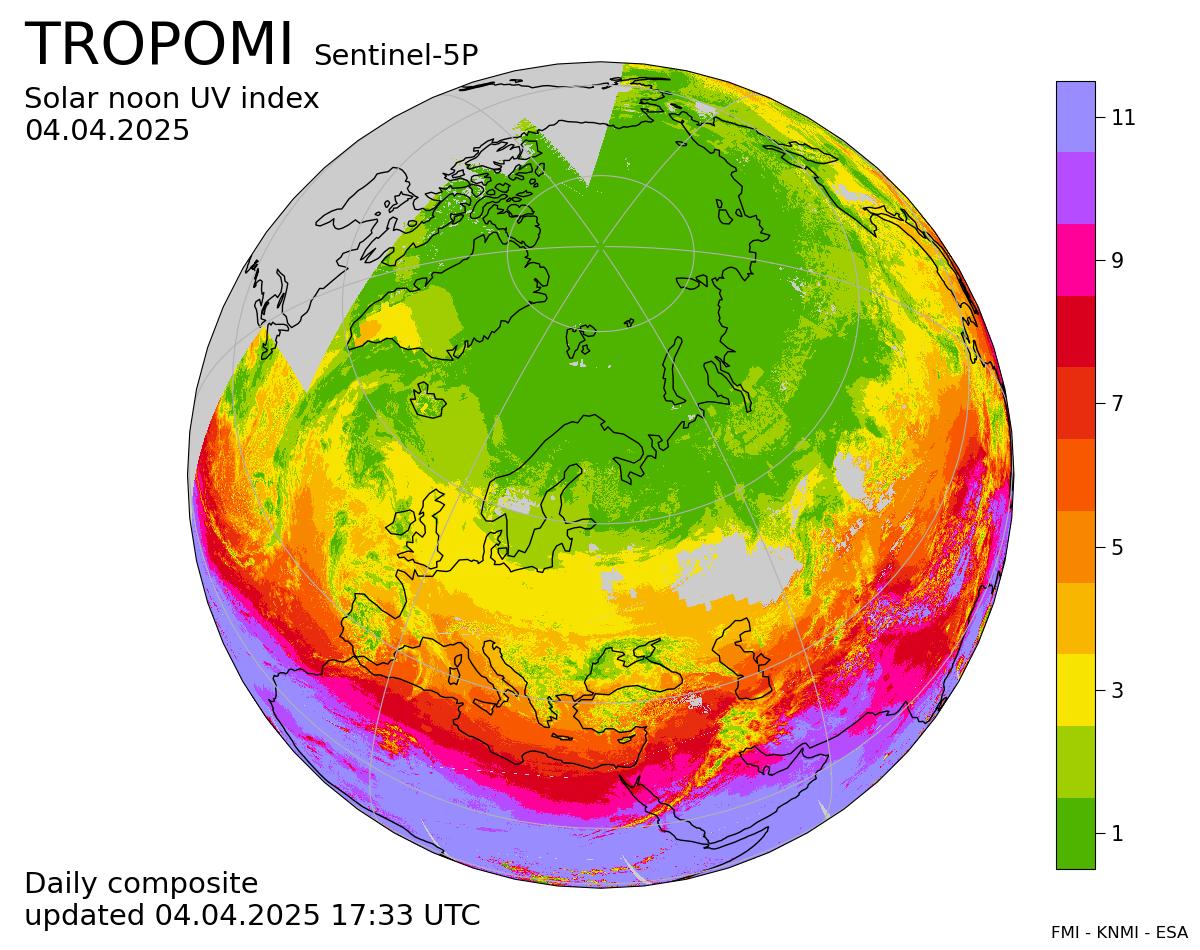
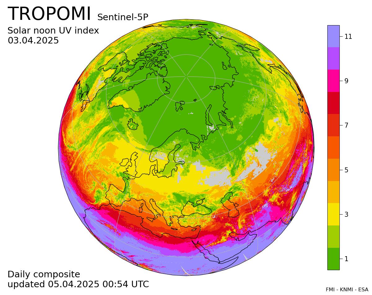
This online platform provides maps of solar noon ultraviolet radiation index (UVI) derived from the
measurements of the TROPOspheric Monitoring Instrument
(TROPOMI)
on board the Copernicus
Sentinel-5P satellite. The UVI describes the level of solar ultraviolet radiation at the Earth's surface.
It varies with solar elevation, the solar noon value reflecting the maximum value during the day. In
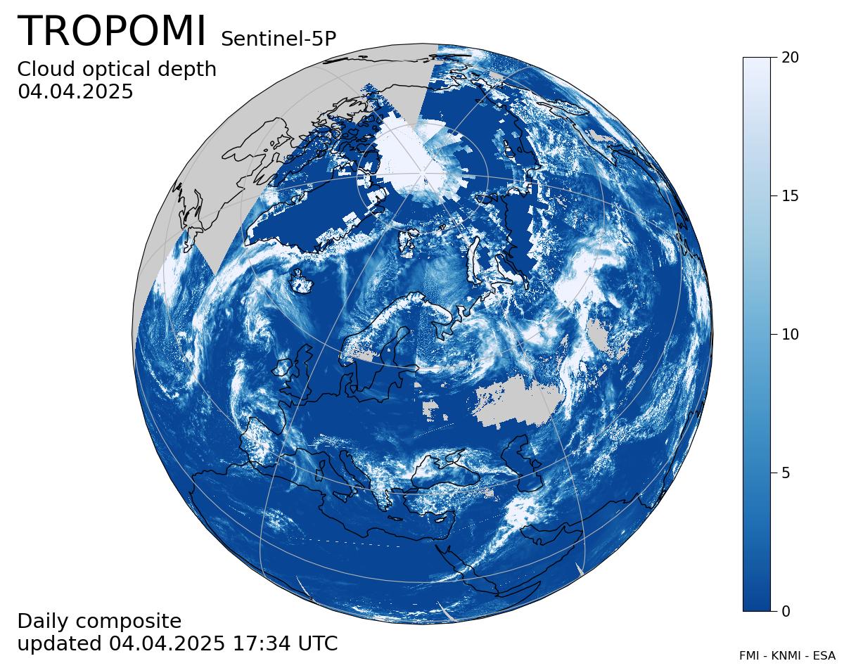
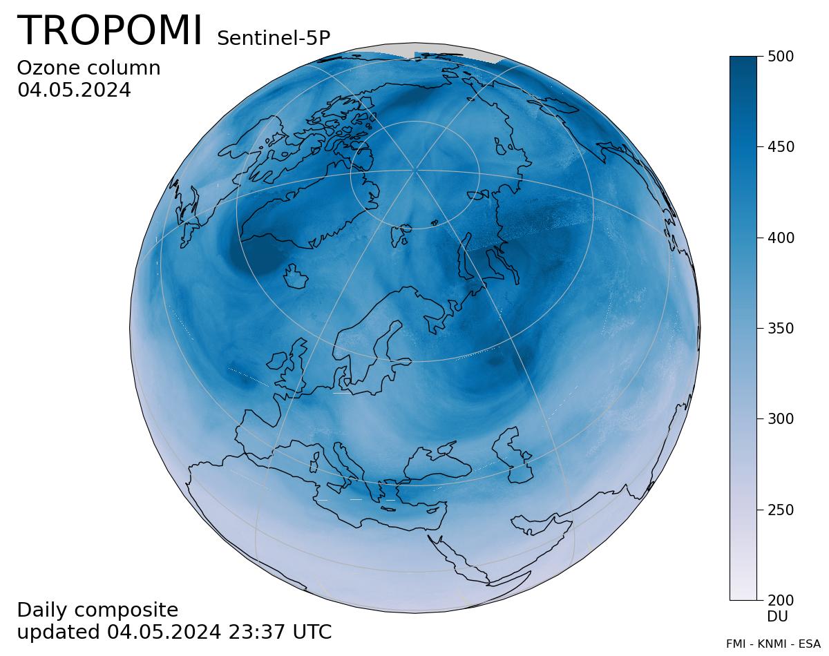
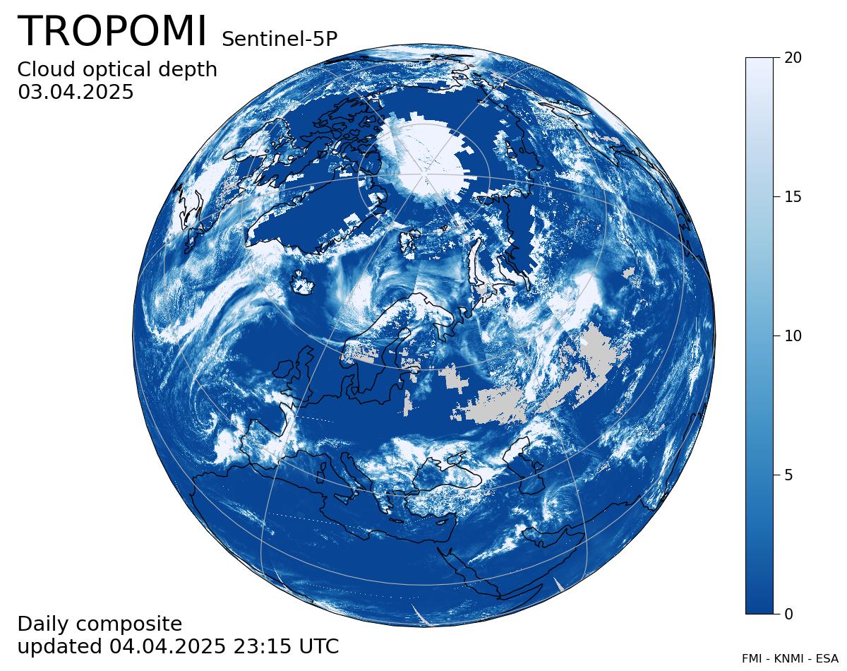
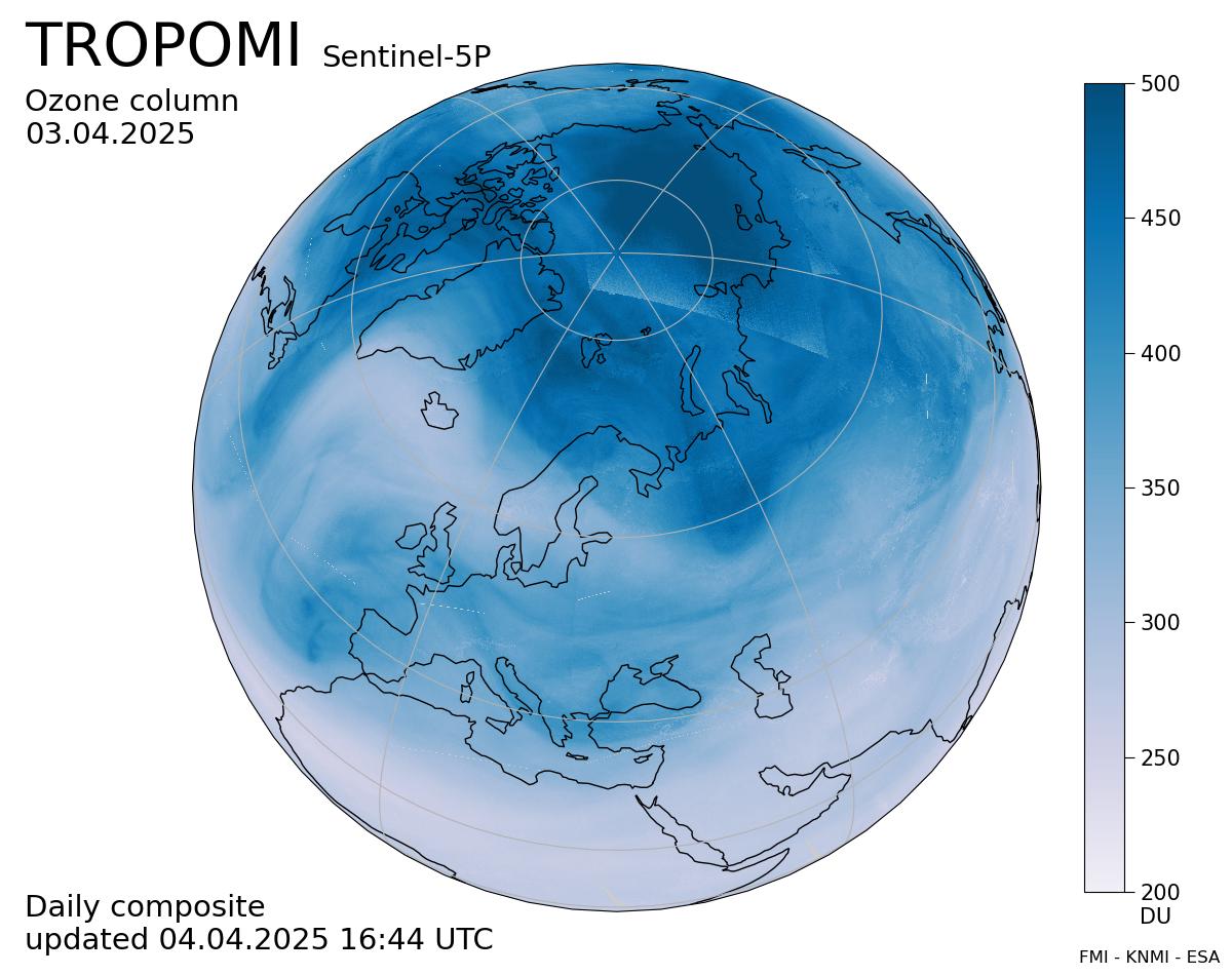
addition to the solar elevation, the UV index depends on the cloud cover and total ozone column,
also shown above. Other contributing quantities include altitude, surface reflectance and aerosol
loading in the atmosphere. The higher the UVI, the greater the potential for damage to the skin and
eyes, and the shorter the time before skin reddening and damage. The color scale designed for
human health warnings ranges from 1 to 11+. Skin protection is needed when the UVI is 3
or above, indicated by non-green colors.
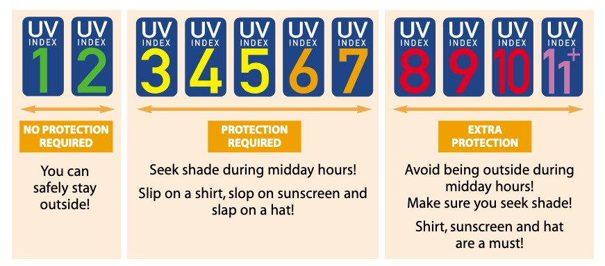
Recommended sun protection scheme with simple “sound bite”
messages. Taken from:
WMO: Global solar UV index: a practical guide.
The Sentinel-5P / TROPOMI surface ultraviolet (UV) radiation product provides daily information
on the prevailing UV radiation levels over the globe (Lindfors et al., 2018). It continues the
satellite-derived surface UV record started by NASA TOMS instrument in 1978 and followed by the
Dutch-Finnish Ozone Monitoring Instrument (OMI) onboard NASA's Aura satellite launched in
2004.
The full product includes the following UV quantities: the UV irradiance at 305, 310, 324, and 380
nm; the erythemally weighted UV; and the vitamin D weighted UV. Each of these are available as
(i) daily dose or daily accumulated irradiance, (ii) overpass dose rate or irradiance, and (iii) solar
noon dose rate or irradiance. In addition, all quantities are available corresponding to actual cloud
conditions and as clear-sky values, which otherwise correspond to the same conditions but assume a
cloud-free atmosphere. The product has been validated against ground-based reference
measurements (Lakkala et al., 2020).
The data are processed in the
Copernicus Sentinel Collaborative Ground Station in Sodankylä in
Finnish Lapland, some 100 km north from Arctic Circle. The ground station is part of the
National
Satellite Data Centre operated by Finnish Meteorological Institute's
Arctic Space Centre. Two data
processing streams are in place: the offline stream processes full orbits orbits, available within a few
days after acquisition, while the near-real-time stream processes 5 minute dumps of data delivered
within 3 hours from data acquisition. This page shows daily composites of solar noon UV index
from the near-real-time stream. The surface UV products are available from the
data centre
while the other TROPOMI/S5P data, such as the ozone total column shown above, are freely available via
the
ESA Sentinel hub.
Lindfors, A. V., Kujanpää, J., Kalakoski, N., Heikkilä, A., Lakkala, K., Mielonen, T., Sneep, M.,
Krotkov, N. A., Arola, A., and Tamminen, J.: The TROPOMI surface UV algorithm, Atmos. Meas.
Tech., 11, 997-1008,
https://doi.org/10.5194/amt-11-997-2018, 2018.
Lakkala, K., Kujanpää, J., Brogniez, C., Henriot, N., Arola, A., Aun, M., Auriol, F., Bais, A. F.,
Bernhard, G., De Bock, V., Catalfamo, M., Deroo, C., Diémoz, H., Egli, L., Forestier, J.-B.,
Fountoulakis, I., Garane, K., Garcia, R. D., Gröbner, J., Hassinen, S., Heikkilä, A., Henderson, S.,
Hülsen, G., Johnsen, B., Kalakoski, N., Karanikolas, A., Karppinen, T., Lamy, K., León-Luis, S. F.,
Lindfors, A. V., Metzger, J.-M., Minvielle, F., Muskatel, H. B., Portafaix, T., Redondas, A.,
Sanchez, R., Siani, A. M., Svendby, T., and Tamminen, J.: Validation of the TROPOspheric
Monitoring Instrument (TROPOMI) surface UV radiation product, Atmos. Meas. Tech., 13, 6999–
7024,
https://doi.org/10.5194/amt-13-6999-2020, 2020
World Health Organization, World Meteorological Organization, United Nations Environment
Programme & International Commission on Non-Ionizing Radiation Protection. (2002). Global
solar UV index : a practical guide. World Health Organization.
https://apps.who.int/iris/handle/10665/42459
Jukka Kujanpää
Finnish Meteorological Institute Space and Earth Observation
Centre
Erik Palménin aukio 1
00560 Helsinki (Finland)
email: name.surname@fmi.fi